Oil Spill Trajectories
 Download this page in PDF format
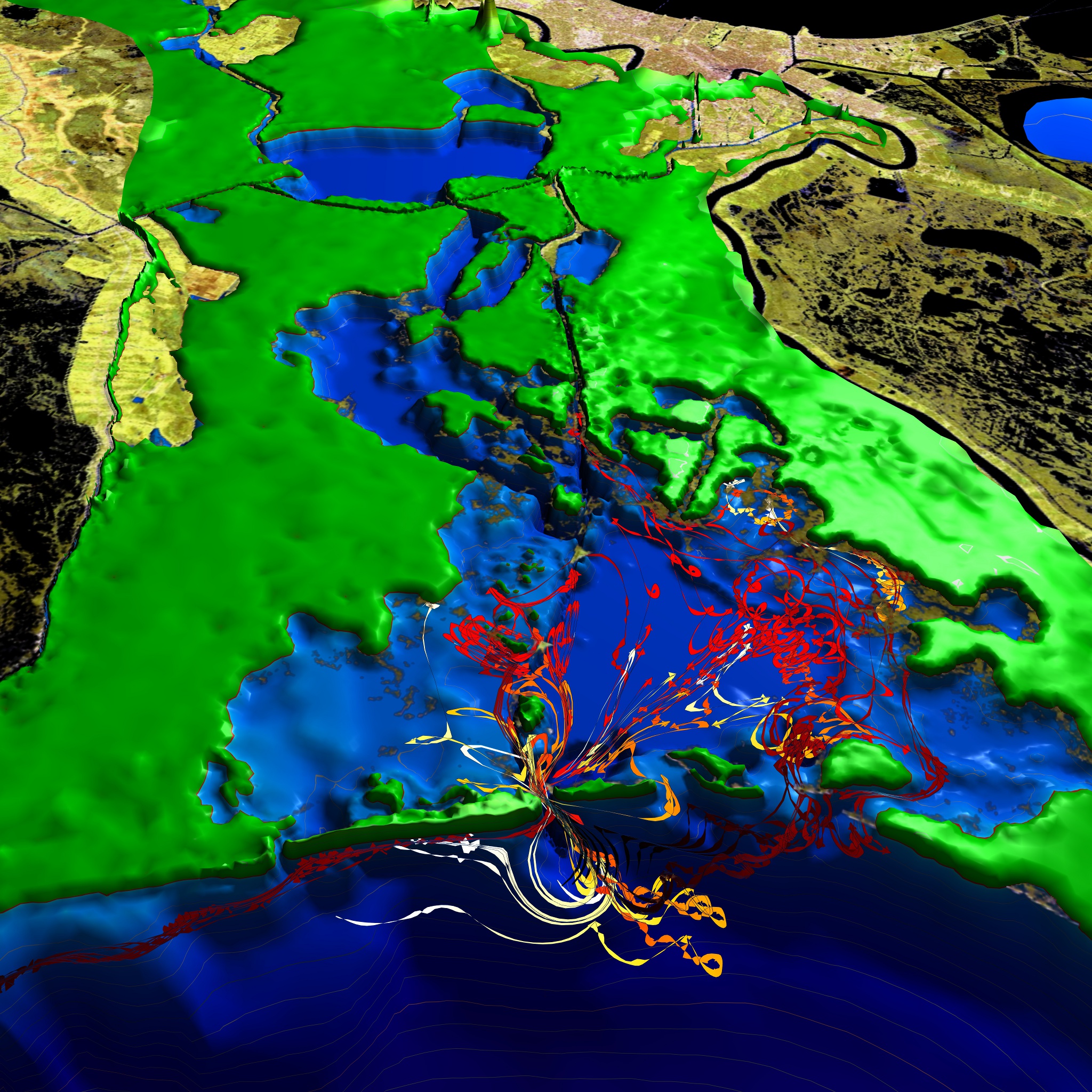
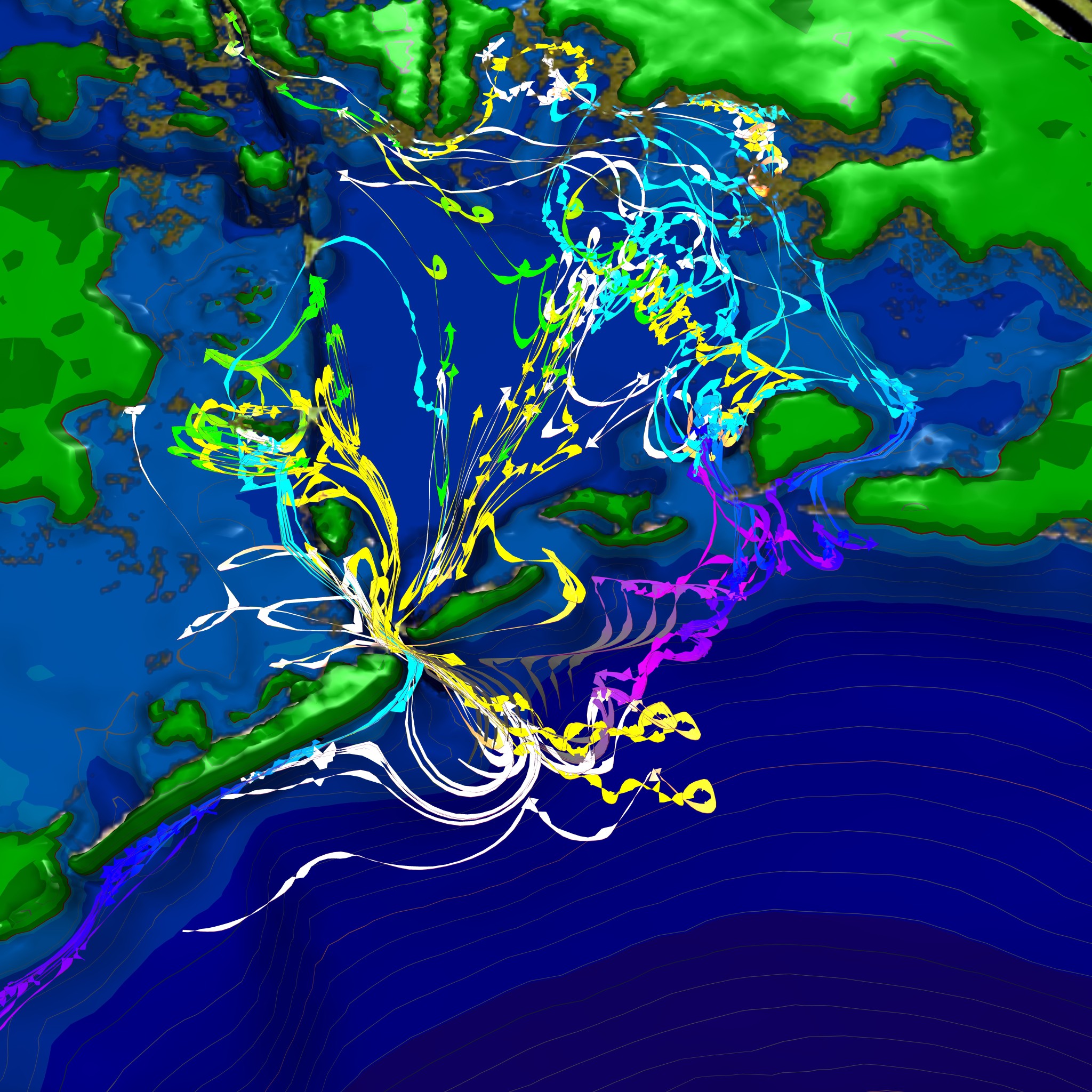
Scientific Visualization of a numerical simulation of the Oil Spill in the Barataria Bay
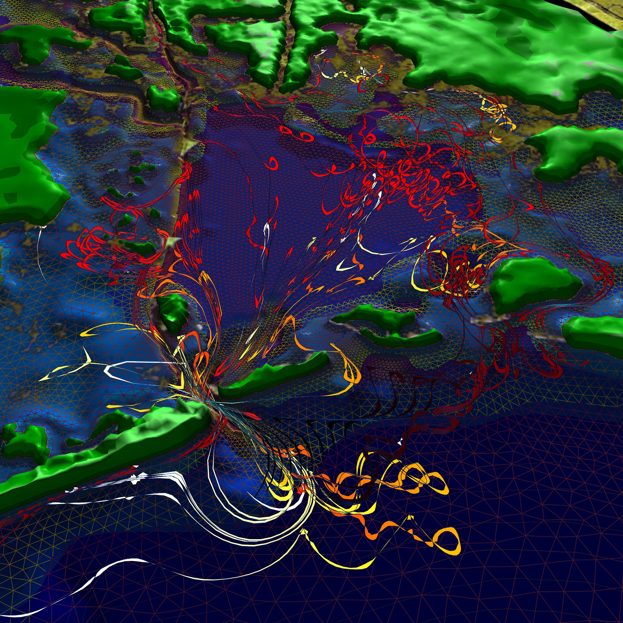
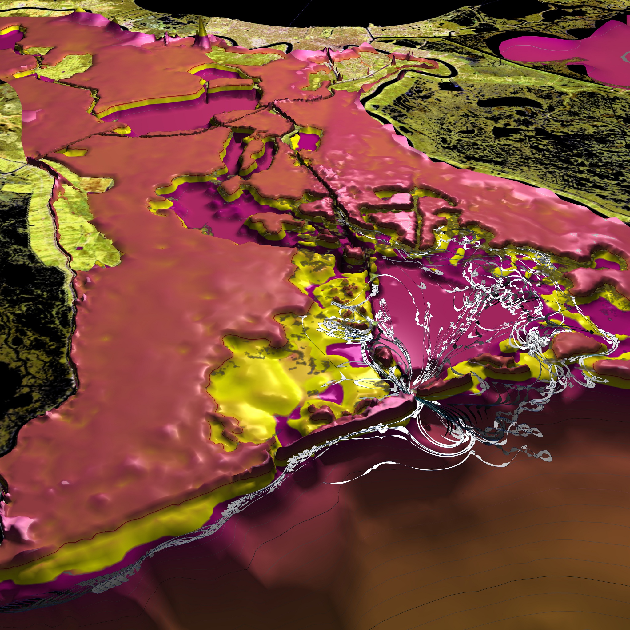
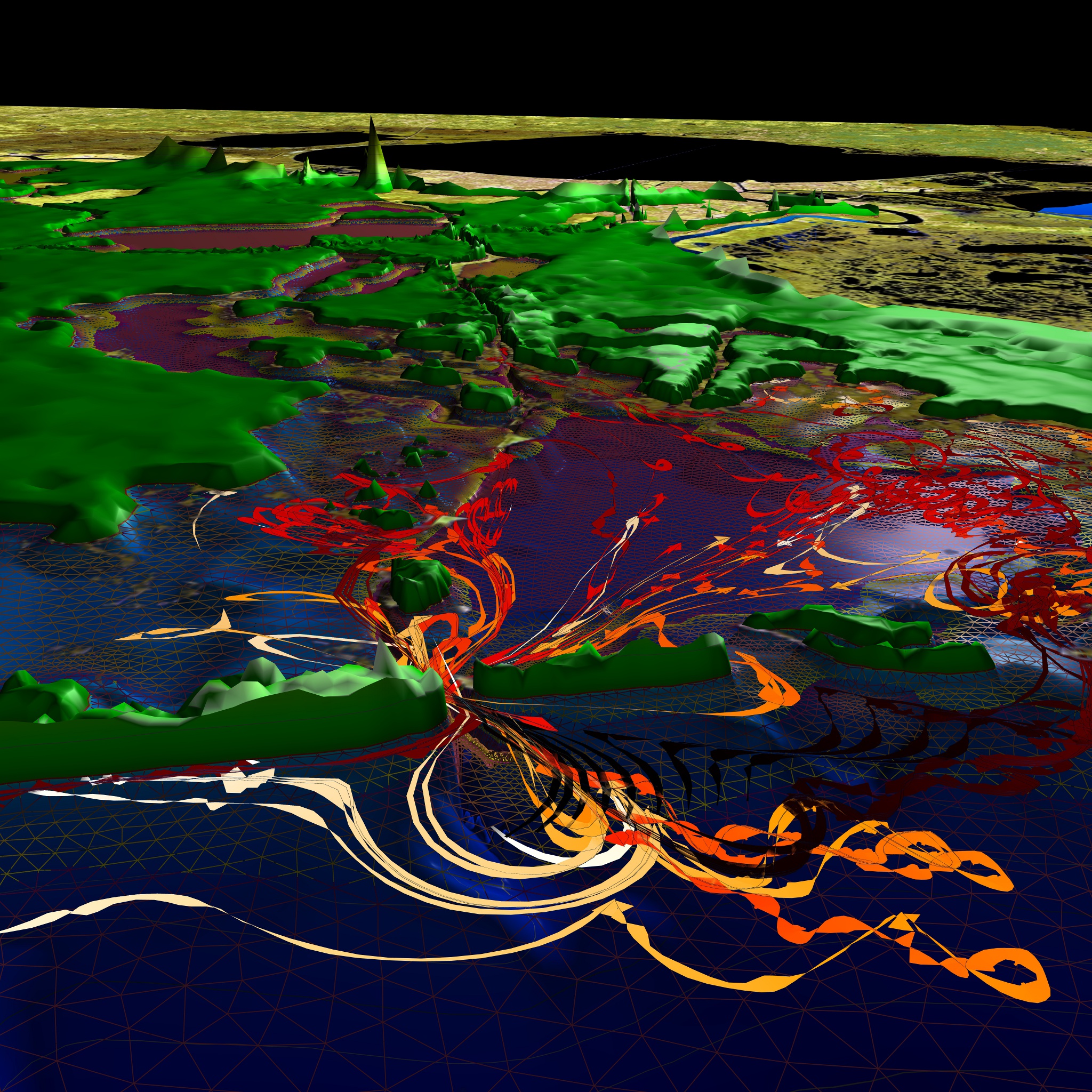
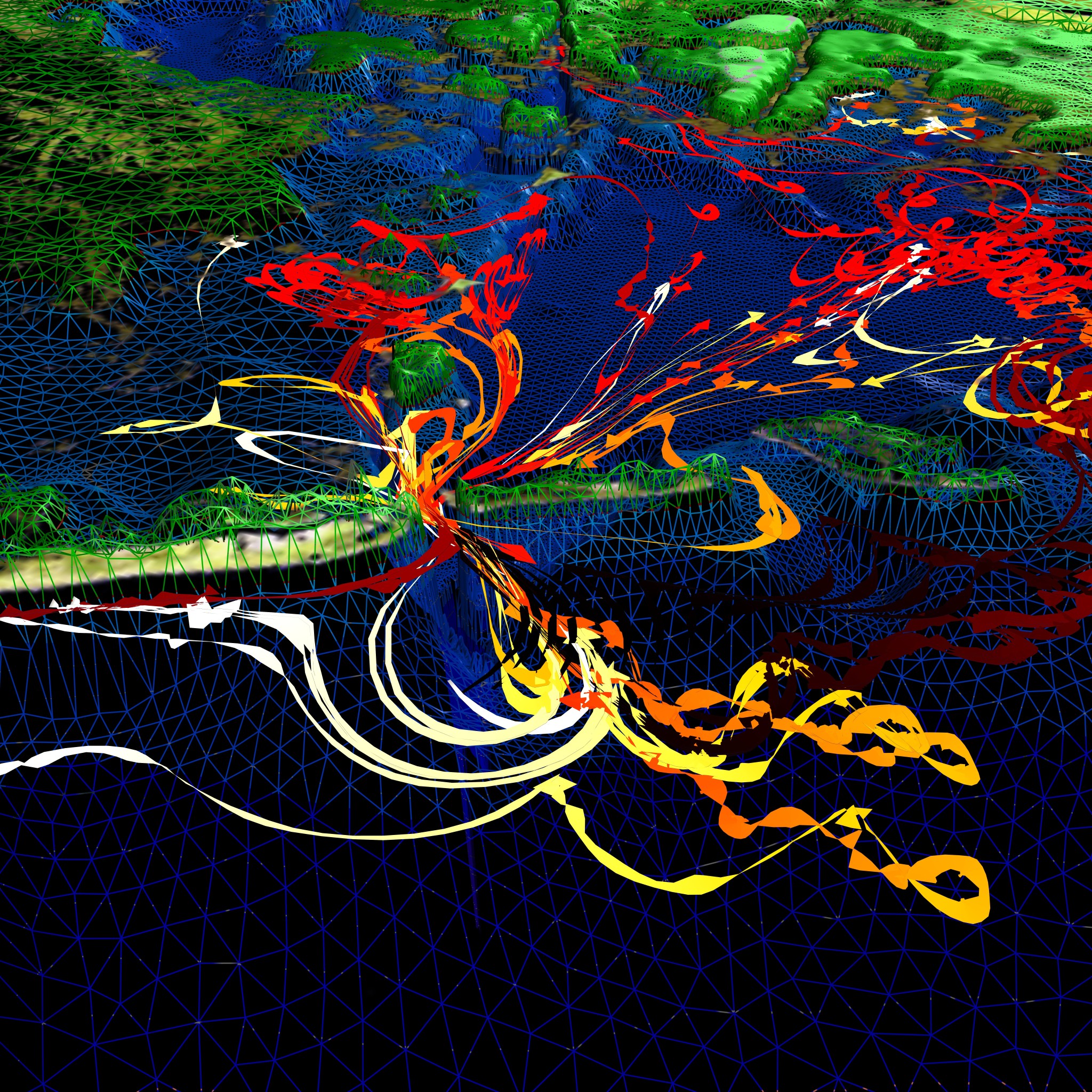
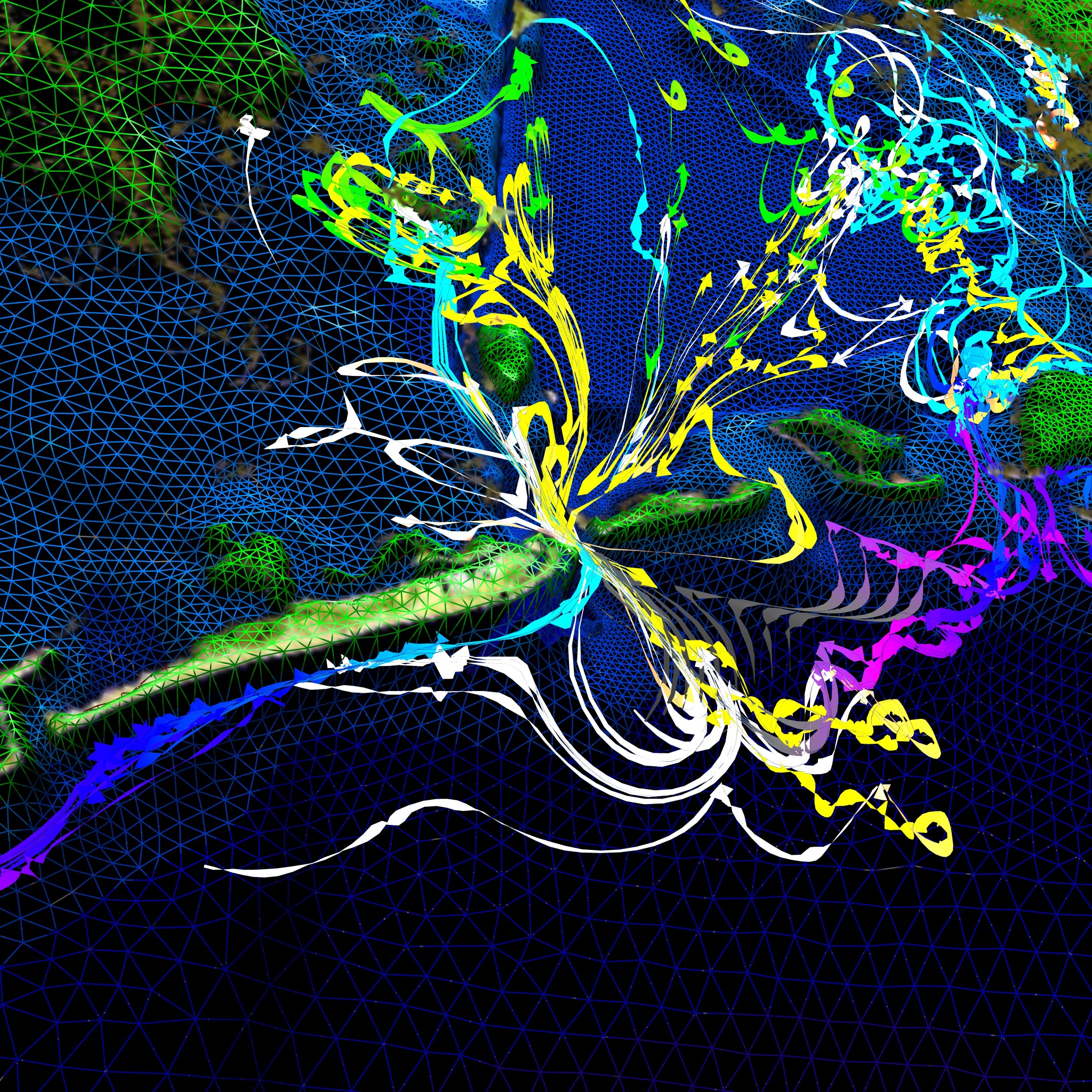
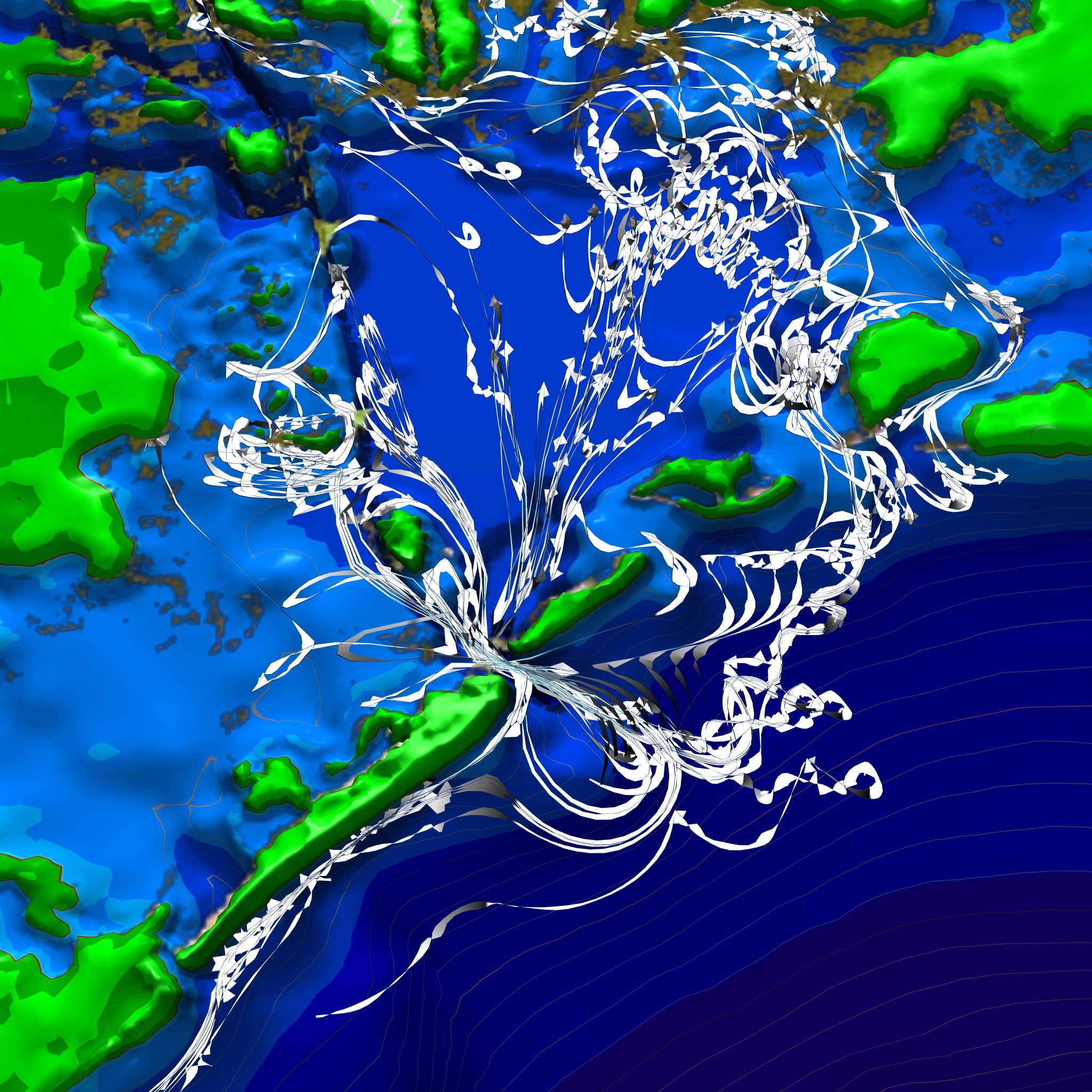
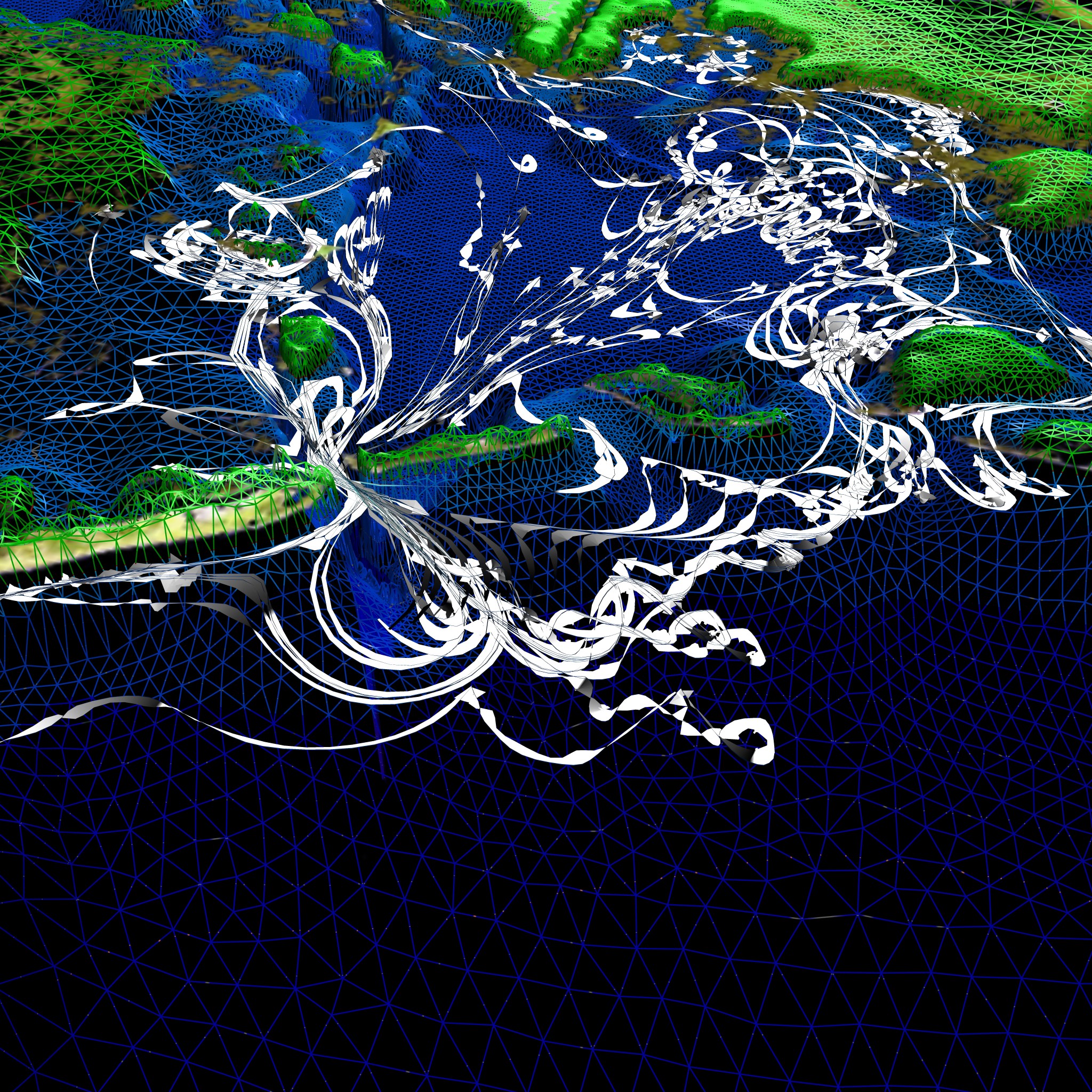
Barataria Bay is a complex estuary south of New Orleans. Oil particles originating in the open waters close to the Gulf’s coast line flow under the tidal influence into the estuary and back into the open water. The extraordinarily deep (~20m) Barataria Pass plays an important role in this process, among other tidal inlets. Particles swirl around with the tidal flow and those not captured at the coast line are eventually dragged out again into the ocean. In most of the following visualization the particle’s trajectories start out in dark red, brighten up to
light red, transiting into orange and yellow as they age. They finish in white colorization at the end of their lifetime.
The images are based on multiple datasets provided by the department for Oceanography and Coastal Sciences at Louisiana State University:
- two high-resolution triangular meshes providing the Bathymetry of the Barataria Bay and the Northern Gulf Coast, respectively
- trajectories of 17 test particles evolving over 625 time steps
- satellite images of Louisiana for providing context information.
We employed the Vish Visualization Shell, a highly customizable visualization framework, utilizing specifically developed or adapted visualization methods. The bathymetry meshes have been rendered with using display techniques inspired by cartographic displays, based on hypsometric tinting and contour lines. The Oil Spill’s particle trajectories are depicted using non-linearly scaled Frenet Ribbons which allows to emphasize their flow and curvature properties.
Authors:Werner Benger, Isaac Ayyala, Neha Manya, Dubravko Justic, Lixia Wang.
Funded in part by BP through the grants to Louisiana State University and Coastal Waters Consortium as part of the BP GRI 3 Initiative.