Influence of Hurricane Gustav on the Gulf Oil Spill |
|
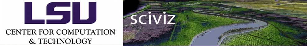
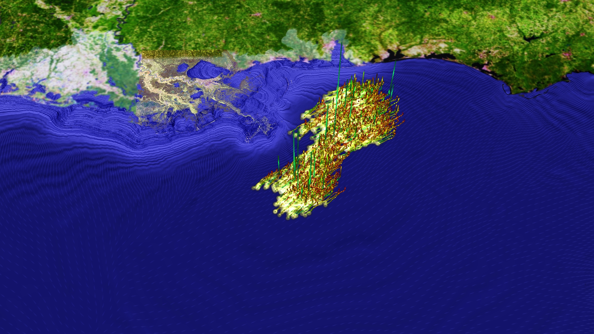
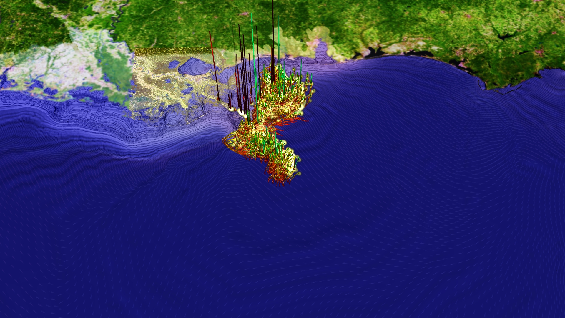
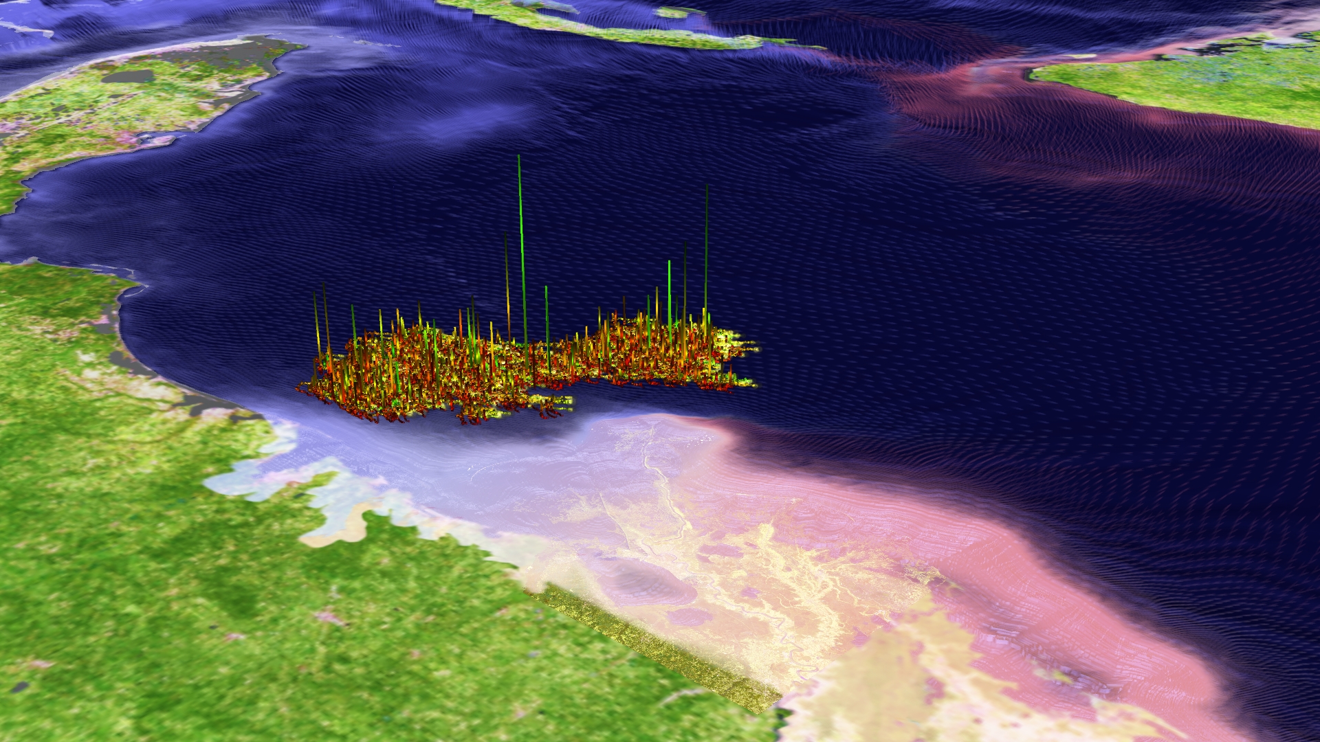
This video shows an oil spill simulation based on Cactus computational framework. The path-lines are colored by arclength of the lines. The particles move in the XY-plane. An additional scalar field is illustrated by offsetting the line positions in Z-direction, illustrating the curvature of the trajectories. This marks positions of the particles with high changes in directions. The ADCIRC model is the source of the elevated water surface that is shown as an elevated and color-mapped surface. Also the wind vector-field which is shown using vector-speckles on the terrain grid is provided by the ADCIRC data. An aligned 50m resolution satellite image shows the Mississippi delta in the foreground. A 500m resolution covers the background. The arrow illustrates North direction. (simulation by Jian Tao, visualization by Marcel Ritter) More about the work can be found at http://www.cct.lsu.edu/~jtao/cct/oilspill/Oilspill_EMI2010_1111.pdf. |

|
© 2005-2010 Center for Computation & Technology at Louisiana State University
Web Design by Amanda Long, Ana Buleu, Werner Benger