
|
|||||||
|
||||||||||||||||

 |
| Click image to see full resolution. |
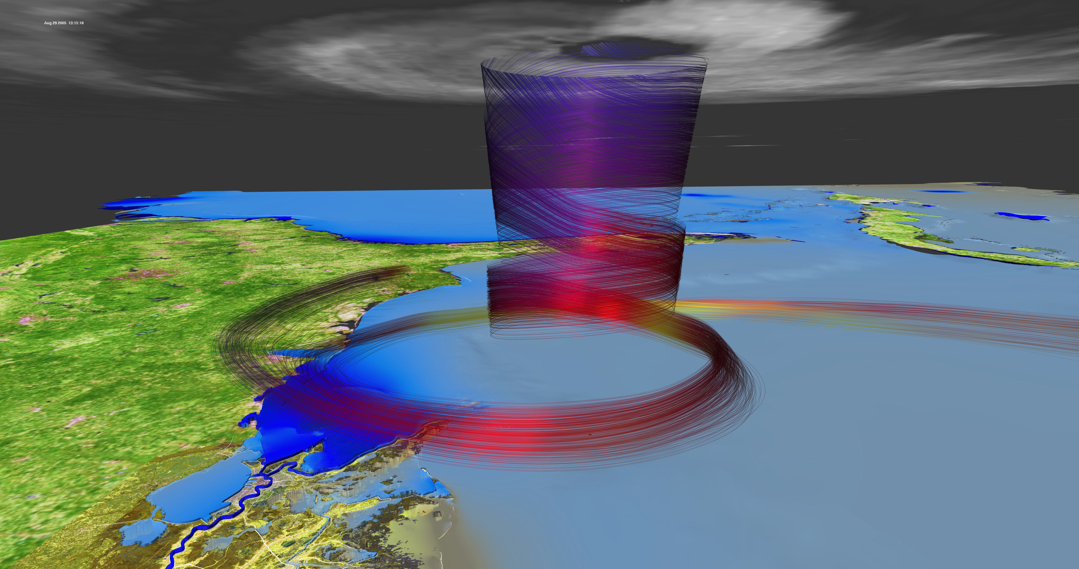
All Data shows a view of the computer simulated MM5 wind isolines aligned with the GOES-12 satellite imagery and the ADCIRC storm surge in dark blue. The land is made of Modis and Landsat images. Download movies below by clicking link.
|